
EyeRes Project was developed during the European Space Agency (ESA) Space App Camp 2019. The purpose of the project is to enhance satellite images with artificial intelligence and machine learning.
Check out my previous post regarding my experience at European Space Agency Space App Camp 2019 here.
Problem
The problem is that the higher resolution data from satellites are not accessible to the public. Mostly because, they are
VERY expensive $💰💰💰💰
“We have decided to apply artificial intelligence (AI) the on ESA’s satellite Sentinel 2 data and improve their resolution.”
Solution
We were working with satellite images from Sentinel and enhancing the resolution with artificial intelligence. Smart cities and people who working on satellite imagery is crucial to identify specific characteristics such as buildings, cars, etc. Companies on the market nowadays charging 5000USD for a single tile on high-resolution data. Sentinel 2 data is already used a lot for the 10m resolution images and with the help of AI we can offer the better resolution for the cost of the price. Based on our neural network training we improve the HR satellite images up to 5m. Our product is targeted to anyone who needs satellite data in good resolution developers, media, research institutions, startup companies and businesses using satellite imagery nowadays as Space Know.
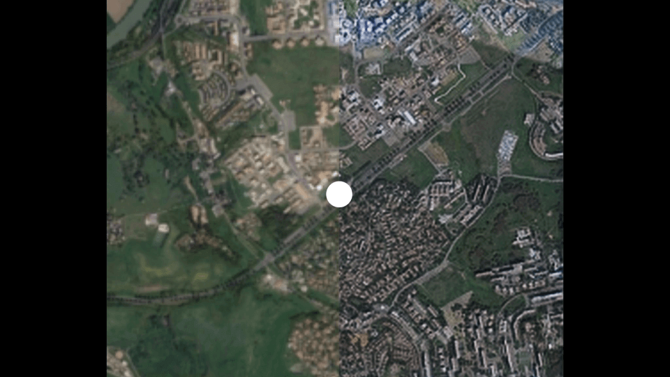
the AI enhanced sentinel 2 image on the right hand side
That’s it for now.
If you liked this article, then please subscribe to my YouTube Channel for video tutorials.